


Yorkshire Dales Park UK charts app for iPhone and iPad
Developer: Flytomap
First release : 03 May 2010
App size: 22.84 Mb
Flytomap - "Solutions for better voyages"
About the Park:
The Yorkshire Dales National Park is in northern England. It encompasses thousands of square miles of moors, valleys, hills and villages. Southeast, on the River Wharfe, the Bolton Abbey Estate includes the ruins of a 12th-century monastery. Malham Village features a towering cliff, and a footpath leading to Gordale Scar, a limestone ravine with waterfalls. A 5-arched bridge crosses the river at Burnsall Village.
Did you know: The Forbidden Corner is a unique labyrinth of tunnels, chambers, follies and surprises created in a four acre garden in the heart of the Yorkshire Dales.
About Map features:
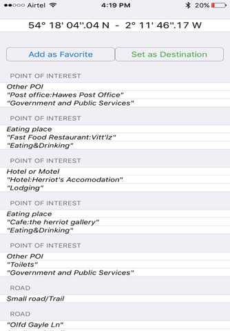
Offline Park Map
Satellite Map Overlay
Topo Map Overlay
GPS to locate positions
Compass
Add unlimited Favorites
Record & email Tracks
Email favorites & Photos
Search places by name & Lat/Lon
Turn ON/OFF names and Elevation contours to avoid clutter
“Insert the target/destination ‘Waypoint’ and see in real time your speed, distance and direction to destination”
“Zoom, Rotate and Pan fast just by a finger touch”
“Geo-Tagged photo management”
................................& more
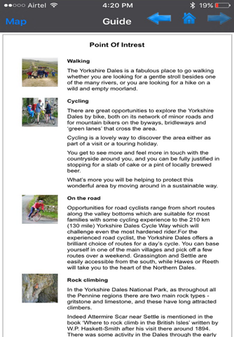
"Park Map contains Guide for quick reference with necessary links"
"Enjoy great voyages"
NOTE:
• Continued use of GPS running in the background can dramatically decrease battery life.
• Turn off GPS when not in use